Midtown in Motion
- 4 min to read

About the city.
The center of Manhattan is characterized by closely located signaled Cartesian grids of one-way streets, with short blocks along avenues and long blocks along intersections. There is a significant demand for transportation due to the extremely high concentration and variety of activities in this area. Car traffic is often mixed with many pedestrians, while intersection spillback arising from overflow queues is frequent, especially in the vicinity of business activity centers.
Goal
The aim of the project is to address traffic congestion from both demand and supply sides simultaneously.
Implementation period. Project started in 2011.
Fact
Traffic congestion is a serious problem in urban areas. In 2010, the national congestion cost in the U.S. rose to $101 billion and was projected to continue to grow to $133 billion in 2015 and $175 billion in 2020.
Solutions
The system, dubbed Midtown in Motion, includes 100 microwave sensors, 32 traffic video cameras, and E-ZPass readers at 23 intersections to measure traffic volumes, congestion, and record vehicle travel times over an area of approximately 110 square blocks bounded by Second-Sixth Avenue and 42nd-57th streets.
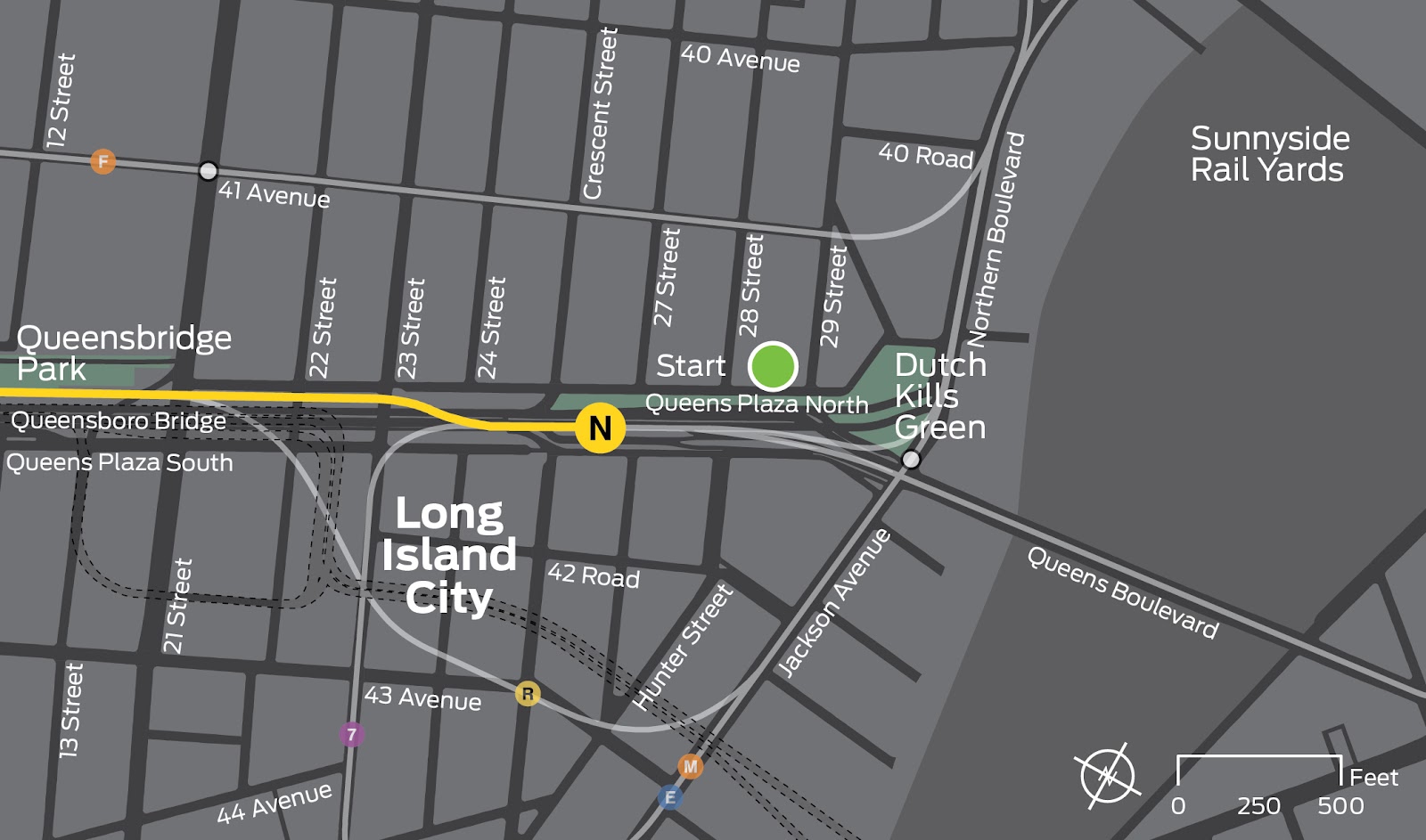
The combined data is transmitted wirelessly to the city’s traffic management centre in Long Island City, allowing engineers to rapidly identify congestion points as they occur and remotely adjust traffic light patterns in the city centre to eliminate traffic jams. Department of Transportation engineers uses recently upgraded traffic light control systems to adjust traffic lights. Real-time traffic information is available to motorists and app developers for use on PDAs and smartphones. The wireless system was made possible by using the New York City Wireless Network (NYCWiN), a wireless network developed and managed by the Department of Information Technology and Telecommunications.
Challenges
The MIM will not expand North of Manhattan because the existing block is already bounded in that direction by Central Park. However, additional traffic monitoring equipment will be installed inside and outside the newly expanded zone.
Team
the New York City Department of Transportation (NYCDOT) and the Federal Highway Administration (FHWA), KLD Engineering, P.C.
Timeline
- Installed in July 2011, the first phase of the program included 100 microwave sensors, 32 road video cameras, and E-ZPass readers at 23 intersections to measure traffic speed.
- Preliminary results from the first stage of the project showed an overall 10% increase in traffic speed on avenues in the 110-block service area, as measured by E-ZPass readers, and taxi GPS data showed similar results.

If you notice an error or inaccuracy in our editorials, please email [email protected] so we can look into it.