The NaviLens App
- 6 min to read
About the city. Accelerating accessibility is a top priority for New York City transit; the 2020-2024 Capital Plan, recently approved by the MTA Board, includes a historic commitment of more than $ 5 billion to make an additional 70 ADA metro stations ADA accessible.
Goal
The aim of the project is to help people with sight loss navigate and find their way around cities independently.
Implementation period. The pilot project’s implementation started in 2019.
Fact
- Visually impaired people have difficulty using traditional signage and therefore cannot be autonomous in an unfamiliar environment.
- The M23 SBS bus route is a popular route, carrying almost 14,500 people on weekdays before the pandemic. It is the eighth busiest bus route in Manhattan, with stops near the Selis Manor Residence for the Blind, VISIONS Services for the Blind and Visually Impaired, and the Andrew Heiskell Braille and Talking Book Library.
Solutions
The Metropolitan Transportation Authority (MTA) and the Transit Innovation Partnership have launched a pilot program that allows blind and visually impaired bus riders to use their smartphones to search for bus stops and get information about arrival times.
The pilot will take place at bus stops along 23rd Street in Manhattan.
The NaviLens app, which can be downloaded to Android or iOS devices, uses an algorithm to translate visual signage into audio and allows customers to determine the exact location and distance to the nearest bus stop, find out when the next bus will arrive, find out how crowded the bus is (if the necessary sensor technology is on board) and be directed at the bus as it approaches the stop.
Video:
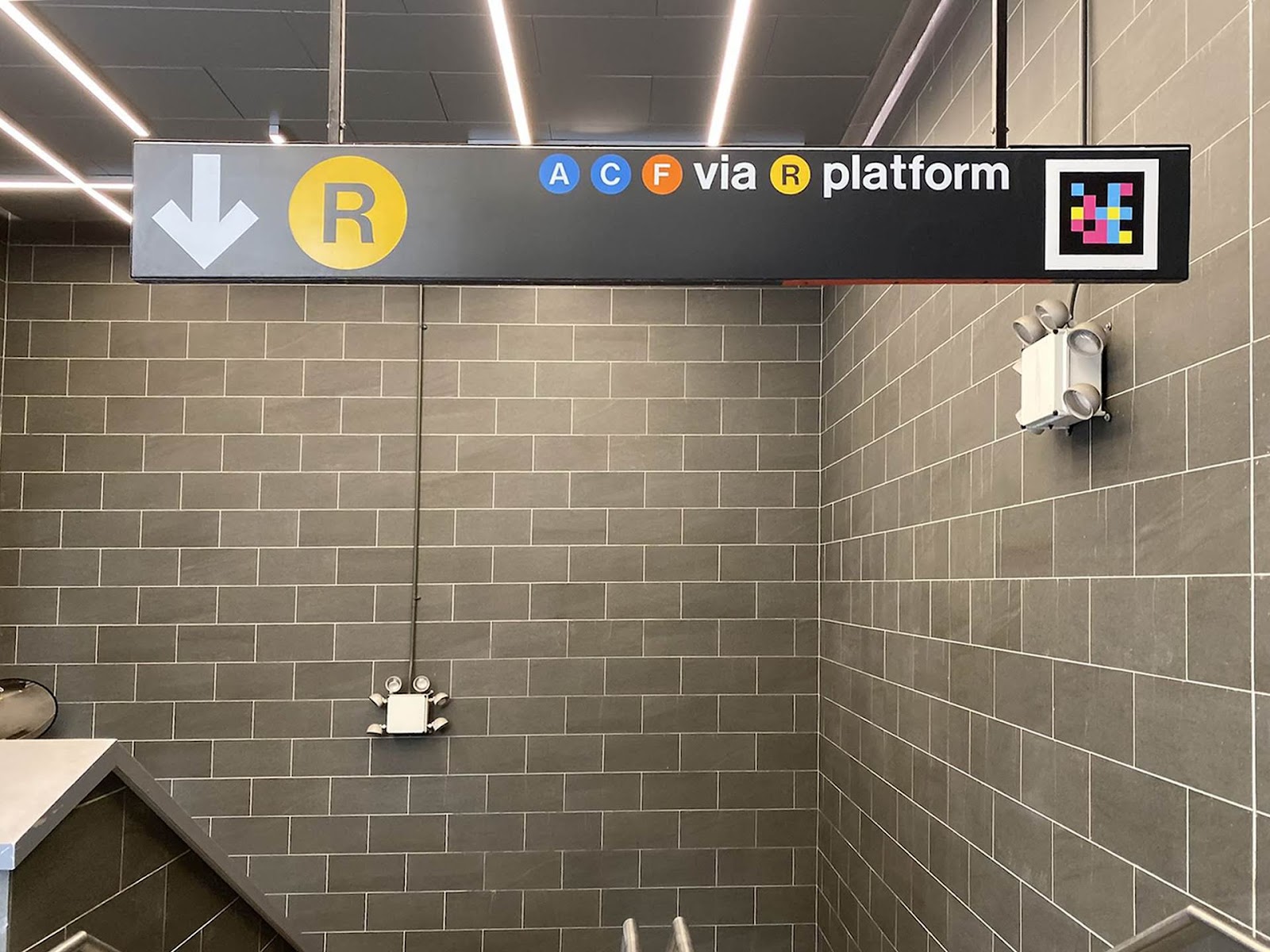
Colourful next-generation QR codes are installed on bus stop poles, which the app can detect from up to 40 feet away and at an angle of up to 160 degrees. The code does not need to be in focus to detect the app and will guide the user by providing audio direction signals, including distance and angle from the code, such as “25 feet, straight”, “right”, etc., solving the “last-few-yards wayfinding problem” for the blind, in which GPS technology does not lead to the exact location of the destination
Two apps are available to interact with this new technology:
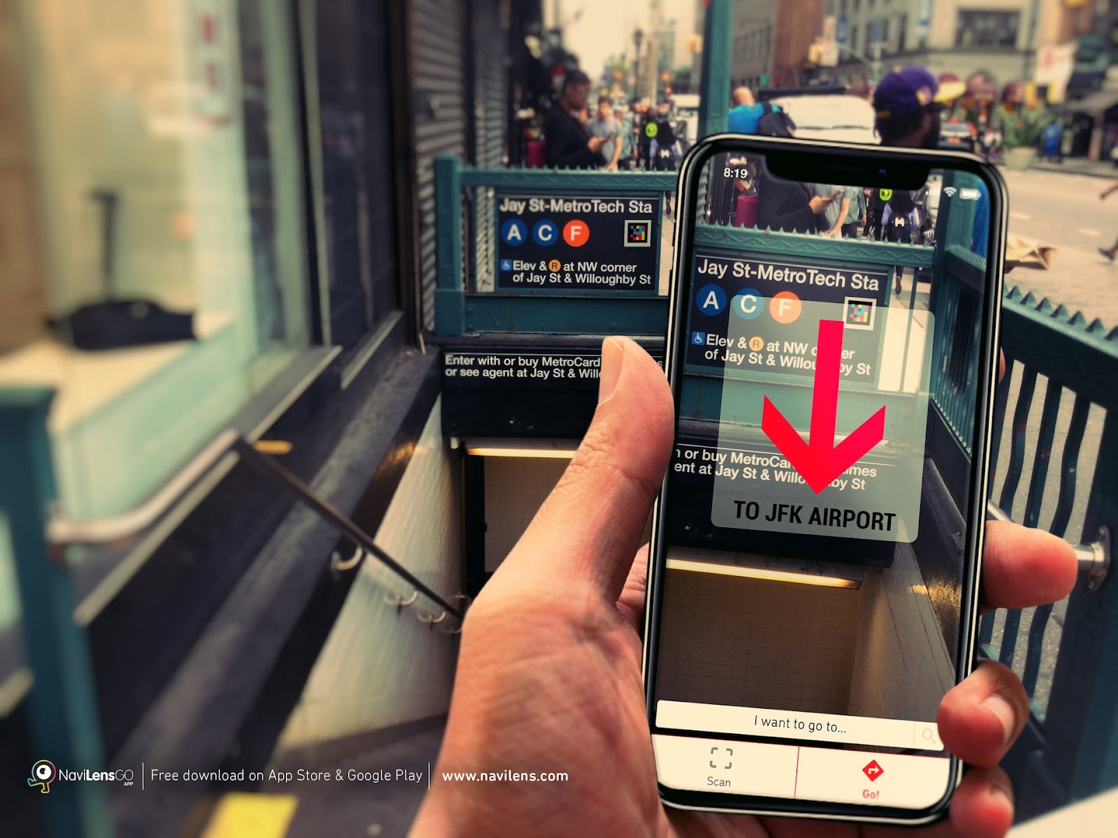
- The NaviLens App helps visually impaired users who can scan codes without having to know exactly where they are, offering the same information as signage, very accurately.
- The NaviLens GO App provides in-station navigation, trip planning information, train arrival information, and service status to help sighted users navigate stations and the system.
Both of these apps offer routes using stairs or elevators and translate information into more than 18 different languages.
Team
The Metropolitan Transportation Authority (MTA) and the Transit Innovation Partnership, assistance from the New York City Department of Transportation (NYCDOT).
Timeline
- NaviLens was introduced to NYCT in October 2019 as one of the technology features tested in the NYCT Accessible Station Lab at the Jay St-MetroTech Station in downtown Brooklyn.
- The MTA said it will pilot the app for one year, when focus groups with members from the New York City Transit Authority and the Transit Innovation Partnership will test the technology and update the app regularly


If you notice an error or inaccuracy in our editorials, please email [email protected] so we can look into it.