Mapping Air Quality in Brooklyn
- 4 min to read
About the city. Mobile sensing fleet has been deployed throughout downtown Brooklyn and nearby potential environmental justice districts (low-income and minority communities experiencing disproportionate environmental impacts), including the Clinton Hill, Gowanus, Red Hook, and Sunset Park neighbourhoods.
Goal
The aim of the project is to provide a precise and comprehensive picture of air pollution in Brooklyn with further emissions reduction and public health protection.
Implementation period. The project started in 2020.
Fact
- Recent Aclima studies conducted in conjunction with the EPA, EPRI, and Envair have shown that air pollution can vary eight times or 800% from one block to another.
- In 2014, the World Health Organization estimated that about 7 million people die prematurely every year as a result of exposure to air pollution and long-term exposure to relatively small amounts can affect every part of the human body at every stage of life.
- Recent studies have shown a strong correlation between a higher exposure to air pollutants, including small particulates and adverse outcomes COVID-19, including a higher mortality rate.
Solutions
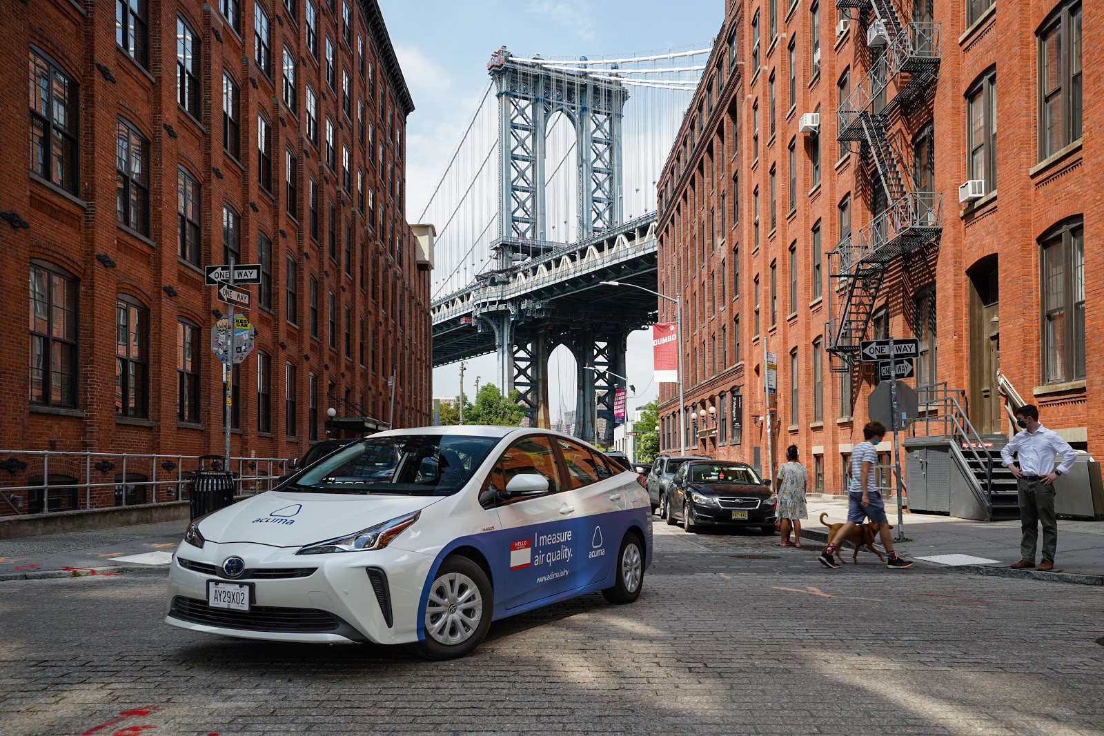
Aclima has deployed its mobile sensing fleet throughout downtown Brooklyn to collect representative air samples using its platform-day and night, weekdays and weekends.
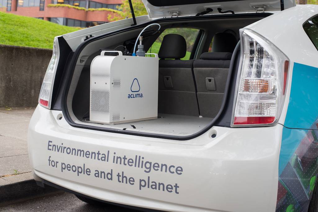
To deploy their mobile sensor network, Aclima engineers and technicians equip low or no emissions vehicles with Aclima’s breakthrough sensing devices.
When cars pass through city streets, air samples are passed through a specially designed air intake and then sent to the device for initial analysis. A combination of sensors and communication components geotag air quality data points and continuously transmit these hyperlocal measurements to the cloud. Each week, Aclima sends billions of new air quality data points to the Aclima Pro cloud-based software for use by governments, communities, and businesses to inform about measures to reduce emissions and their impacts.
Team
Aclima in collaboration with NewLab, the New York City Economic Development Corporation, and the Downtown Brooklyn Partnership
Timeline
Results from Aclima’s first hyperlocal measurement campaign in Brooklyn will be shared publicly later this year (2020) at a showcase as part of the Circular City Studio.

If you notice an error or inaccuracy in our editorials, please email [email protected] so we can look into it.