20 Green Walks
- 10 min to read
Berlin, Germany
About the city. In accordance with the historical development of the city, the districts needed pedestrian connections between different areas.
Goal
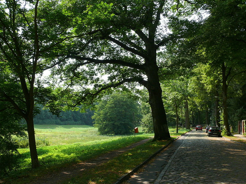
The main aim is to create a network of several walks to connect residential areas with the many diverse leisure facilities in parks and recreational areas in the city and the surrounding areas of the State of Brandenburg.
Implementation period. The planning and legal status of this network of 20 Green Walks in Berlin were started in 1994. Nevertheless, since 2004, construction work has begun.
Fact
The 20 Green Walks in Berlin are based on the “Berlin system of open spaces (Berliner Freiraumsystem)” in the city’s Landscape Programme.
Solutions
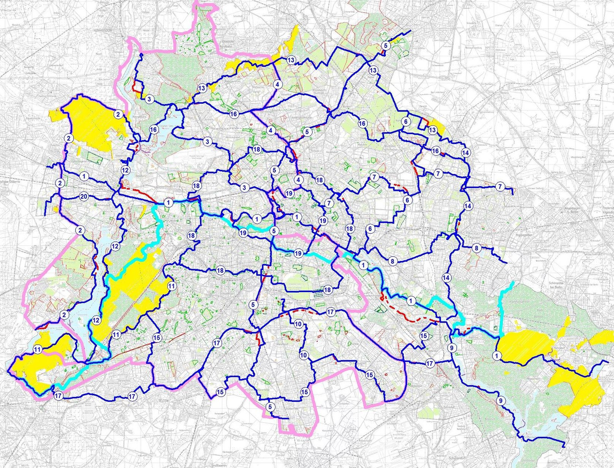
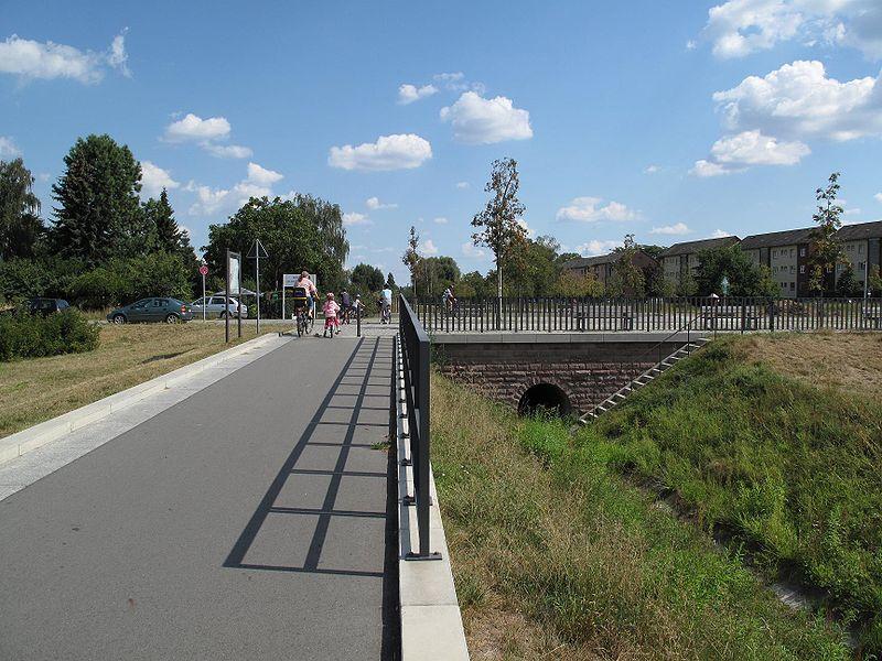
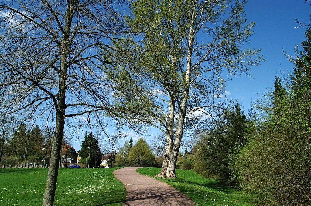
The project is implemented to connect the districts of Berlin, as well as to ensure quiet walks away from the buzz and pollution of the city. Over 100 voluntary hikers took part in the “A Plan for 20 Green Walks in Berlin” project to optimise the network of routes. The routes comprising the 20 Green Walks in the Berlin network stretch around 565 km. The individual walks are named and numbered from 1 to 20.
Team
Not-for-profit associations FUSS e.V. and BUND e.V. with the metropolitan landscape planning office, additionally not-for-profit Berliner Wanderverband e.V. hiking association.
The Senate Department for Urban Development and the Environment officially coordinated a network of walks.
Timeline
1994
Establishing ideal routes
In order to improve the efficiency of green spaces and parks, the Berlin landscape program of 1994 aims to create a close-knit green network that links green spaces with each other and with the settlement areas. These green corridors also represent an attractive network of pedestrian and cycle paths. The “ideal routes” are the routes that, together with parks and other recreational areas, form the “Berlin open space system” of the urban landscape planning.
2004
Project “A plan for 20 main green paths”
The aim of the project is to trace the largely unknown planning for the 20 main green paths, to make them visible and usable. In view of Berlin’s financial situation, the gaps that still exist in the road network are now being identified with the support of over 100 voluntary “strollers” and suggestions for remedying them or for corresponding temporary detours are being collected. The project is organized in cooperation with administrations and private initiatives. The project’s idea came from Ms. Eva-Maria Epple, who has been working for a long time in the context of her Local Agenda 21 activities for the international experience with the successful implementation of “Green Paths for Slow People” – for example, in New York – Interested.
2005
The first digital hiking map
Via the Geoportal (FIS Broker), Berlin’s central portal application for researching and presenting geodata, the network of the 20 main green paths that can be walked at this point in time, including temporary detours for gaps, is displayed for the first time. The map digitized by employees in the urban landscape planning of the Senate Department for Urban Development was created on the basis of strolling reports.
2006
Mutual cooperation agreement
Now it is official: between BUND Berlin eV, FUSS eV Berlin and the State of Berlin, represented by the Senate Department for Urban Development, Department IE, a cooperation agreement is signed on March 20, 2006, which allows cooperation to prepare and implement the 20 green Provides main routes. The cooperation partners aim to make a network of 20 main green paths accessible and tangible for use by those looking for relaxation, which connects public and publicly accessible green and open spaces in Berlin.
2007
Strolling along the Stadtspree
A flyer with the title “Strolling along the Stadtspree – One of 20 main green paths is inviting” is published by Department I of the Senate Department for Urban Development. The leaflet, which is available free of charge, shows the course of the Spreeweg between Charlottenburg Palace and Rummelsburger Bucht and presents more than 50 interesting places along the route that have played or will play an important role in the development of Berlin.
2008
The first analogue hiking map
The end of 2007 was initiated by the Berlin-based piekart publishing house as a public-private partnership between the publisher, nature conservation associations and the Senate Department for Urban Development, in order to bring the first comprehensive hiking map to bookstores in 2008. As early as May 2008, the jointly produced overview map entitled “Strolling – walking – hiking” was available in almost all Berlin bookshops and in the well-stocked press range.
2009
Leaflet “Green Belt Berlin”
As part of the 20th anniversary of the fall of the Berlin Wall, the Senate Department for Urban Development is presenting a leaflet that, based on the European Green Belt, is dedicated to the areas of the former wall that are largely preserved today. The presented northern section of the inner-city Wall Trail is also part of the network of 20 main green routes through Berlin.
2010-2012
Marking the paths
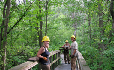
The Senate Department for Urban Development has developed a uniform and cost-effective marking system, which is based on both the short directional signs on Barnim Dörferweg and the nationally common marking of main paths. Encouraged by the general interest, the Berliner Wanderverband eV offered to take over the follow-up care of the paths that have already been marked for the first time. To this end, a binding sponsorship agreement was signed on March 15, 2010. Also, the Competence Center for Engineering Biology eV has agreed to take care of the initial marking of the entire network of paths in Berlin as part of district-related projects. For this purpose, a framework agreement was signed on March 15, 2010.

If you notice an error or inaccuracy in our editorials, please email [email protected] so we can look into it.